|
THE WEALD
Please use our A to Z INDEX to navigate this site
|
|||
|
Sussex is a glorious county, the so-called garden of England and for very good reason. I've lived in Sussex most of my life, including: Brighton, Eastbourne, Seaford, Newhaven, Hadlow Down, and of course Herstmonceux.
There is so much of interest to see and do in the United Kingdom, and I hope to expand the local geography section as time allows, to cover the most interesting aspects of this wonderful country. Please use the links below to navigate around Sussex with my compliments. If you notice any errors in your travels, please let me know. Equally, if you think I should have included something, or indeed, if you'd like to contribute something, I'd like to hear from you.
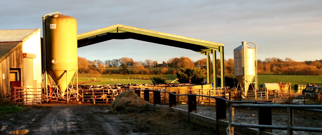
A typical farming scene in December 2017. This farm off Church Road rear cattle. Modern farms are not as attractive as they used to be in merry old England, but they still have a certain something. Copyright photograph © Cleaner Ocean Foundation Ltd, all rights reserved.
Ancient
A weald once meant a dense forest, especially the famous great wood once stretching far beyond the ancient counties of Sussex and Kent, England, where this country of smaller woods is still called "the Weald". Now that most English forests have been cut down, the word may refer to open countryside or to the special clays found in the Weald. Weald descends via Anglo-Saxon weald = "forest" from an ancient Indo-European root meaning "forest" or "wild". It is closely related to the German Wald and Old Norse völlr, both of which descend from the same Indo-European root; both German and Old Norse are sister languages of English.
The Weald
As a geographical term, the Weald is a particular area in the South of England that is situated between the chalk hills of the North Downs and South Downs, and that extends across the counties of Kent, East Sussex, West Sussex and Surrey. It has also been known as the Forest of Andred or Andredswald because in the early Middle Ages it was known to stretch from Andred or Anderida in East Sussex to Dorset, seventy miles long and thirty miles wide.
The High Weald of higher hills, ridges and valleys is part of the Wealden anticline, once layered rock that later rose up and folded upward into an arched incline, as well as steep slopes falling away in certain parts of the area. It covers an area of 500 mile² (1,300 km²) and has been declared an Area of Outstanding Natural Beauty.
Lower parts of the Weald form a gentler rolling countryside which is especially popular with ramblers. The Weald has kept its wooded character to this very day, the forest still covering 23% of the area, one of the highest levels in England. Despite the population pressure in the South of England, it has not resulted in any major urban environment. Small towns such as Tunbridge Wells, Tonbridge, Crawley, Sevenoaks, etc., are local centres which have attracted a certain number of commuters into London without having lost their character of old.
The area was the centre of the Wealden iron industry from Roman times until the last forge was closed in 1820. The use of its timber for the furnaces, but also for the medieval cloth industry and for the use by the shipbuilders on the Thames and Medway, might well have denuded its landscape, but now that all three industries use other raw materials, the Weald remains one of the most heavily wooded areas of England. It is also one of the most important regions whence many English yeomen came to settle the lands across the sea which have since become the United States.
The geological anticline which caused the Weald extends 62.5 km = 37.5 miles further south-south-east under the Straits of Dover and includes the Boulonnais in France. See Straits of Dover.
Other English Wealds
Wooded areas other than those which are situated between the Downs and which have the name Weald are North Weald Bassett in Essex, and Harrow Weald in northwest London.
Wold
Compare wold, which is from the same root as weald, and which originally meant "forest" or "wildlands." It now most often means open countryside or moorlands and especially the rolling uplands in the North of England, the Yorkshire Wolds and Lincolnshire Wolds. LINKS
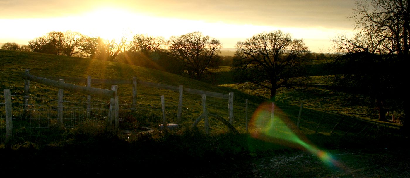
Weald down land December sunset 2017 looking toward Eastbourne in the distance, with the observatory just a mile down the road. Copyright photograph © Cleaner Ocean Foundation Ltd, all rights reserved.
This part of the world is a beautiful place to live in. Each season brings some new joy. Even the cold and rain eventually disappear as the sun rises at the start of the next day for another glorious country adventure, spoiled only by the politics and economics of every day life.
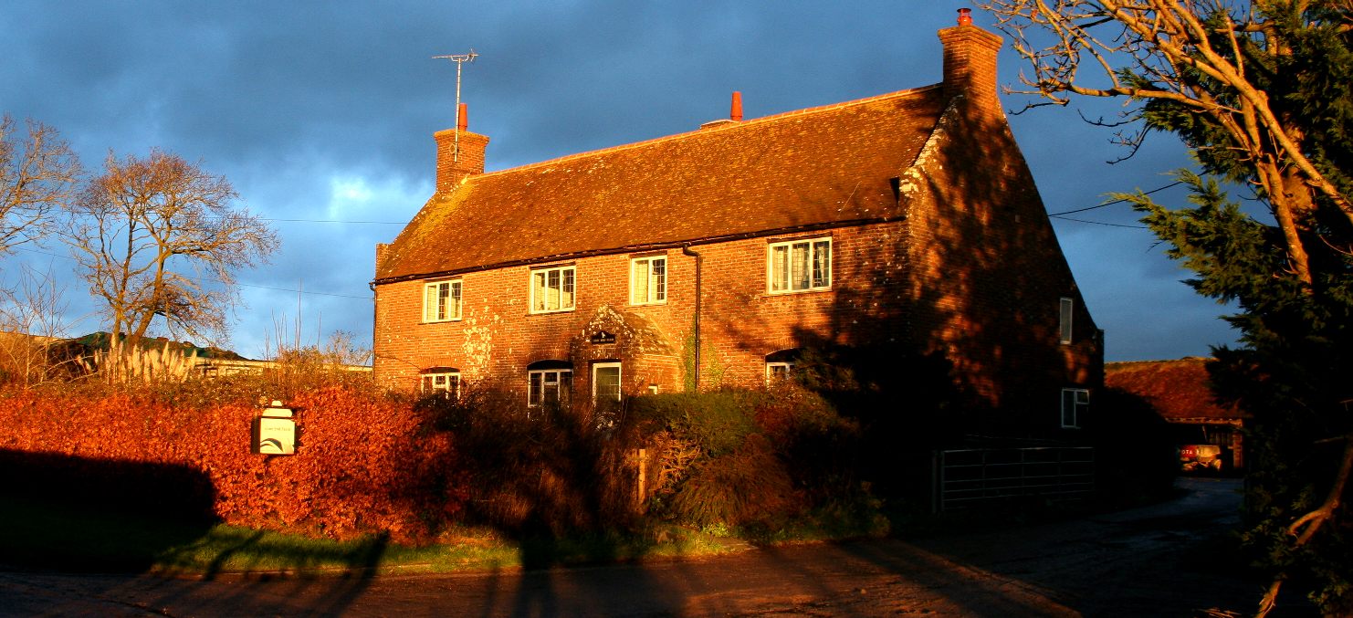
Lime End Farm, Church Road, Herstmonceux in Sussex. December sunset 2017. The Weald was at the heart of the early iron making industry. Copyright photograph © Cleaner Ocean Foundation Ltd, all rights reserved.
LINKS:
http://www.
Anthropology | Archaeology | Dinosaurs | Evolution | Fossils | Geology | Mammoths Meteorites | Paleontology | Plate Tectonics | Neanderthal Man
SUSSEX INDEX A - Z
ARUNDEL CASTLE - WETLANDS WILDFOWL TRUST BEACHY HEAD - BELL TOOT (BELLE TOUT) LIGHTHOUSE BISHOPSTONE CHIDDINGLY - HORSE SHOW and GYMKHANA CUCKMERE VALLEY - EXCEAT EAST
SUSSEX HADLOW DOWN HERSTMONCEUX - CASTLE - CE SCHOOL - LINKS - FESTIVAL - MUSEUM LIME PARK - HERSTMONCEUX - AUGUSTUS HARE SHOREHAM - PORT SUSSEX - SUSSEX BAY, MARINE REWILDING PROJECT TWISSELLS MILL, OLD HEATHFIELD WEALDEN DISTRICT COUNCIL - COUNCILLORS 2023
Solar Cola drinkers care about planet earth
.. Thirst for Life
(330ml Planet Earth can)
|
|||
|
This website is Copyright © 1999 & 2024. The bird logo and name Solar Navigator and Solar Cola are trademarks. All rights reserved. All other trademarks are hereby acknowledged. Max Energy Limited is an environmental educational charity.
|


