|
CHINA
- PEOPLE'S REPUBLIC
|
|||||||||||||||||||||||||||||||||||||||||||||||||||||||||||||||||||||||||||||||||||||||||||||||||||||||||||||||||||||||||||||||||||||||||||||||||||||||
|
China has built up a $170bn (£135bn) stockpile of
gold after a record buying spree, in a move that has raised fears Beijing is preparing its economy for a possible conflict over Taiwan.
China is a CRINK. Part of the axis: China, Russia, Iran and North Korea. The CRINKs are allegedly communist nations working together against the interests of the democratic free world. They are trading oil and cheap goods to build up a weapons arsenal, in what is more than just a Cold War. It is an open threat to NATO allies.
China declares itself to be a People's Republic. But is in fact might be considered a dictatorship, until there are genuinely free elections and real human rights.
China is signalling it is ready to deploy the economic "nuclear option" and willingly devalue the yuan as Beijing ramped up the purchase of commodities in recent weeks.
WORLD WAR THREE
We are on the brink of WWIII. Solutions are not to purchase fossil fuels from the CRINKs. And that includes India, who is refining oil and supplying to the West to defeat sanctions aimed at stopping Russian's illegal aggression in Ukraine. Thus, India under Narendra Modi, might be treated as a proxy CRINK.
Other solutions are to manufacture solar panels and batteries in NATO countries. To quickly install wind farms and speed up the infrastructure necessary for EVs and green hydrogen for FCEVs, and ICE vehicles to run on methanol.
World War Three will be a war to eradicate extremist dictators. Meaning communism and religious dictators, against the free democratic world. It is possible that may also include taking out Royal families. Especially those who tolerate and are thus party to corruption in their country. This of course includes the United Kingdom where the police are puppets to corrupt councils. A cancer in society.
If there is going to be a nuclear exchange, we might as well eradicate all of these evils in one fell swoop. The survivors of any nuclear holocaust might then build on the ashes of evil, for a sustainable future, where it is illegal for politicians to lie. A law proposed by
ABOUT CHINA
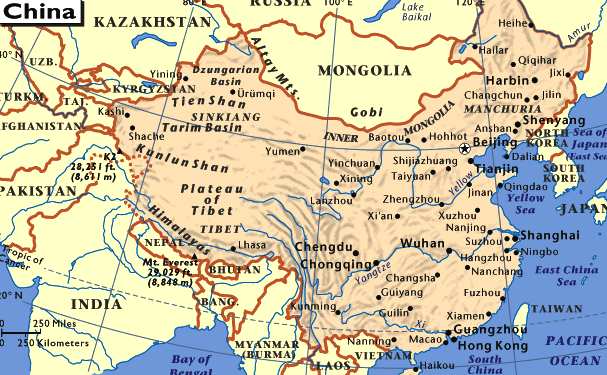
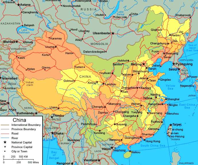
China is situated in the eastern part of Asia, on the west coast of the Pacific Ocean. It is the third largest country in the world (after Canada and Russia). China has a total land area of 9.6 million squares kilometers. The distance from east to west measures over 5,200 kilometers, and from north to south, over 5,500 kilometers. When the sun shines brightly over the Wusuli River in the east, the Pamire Plateau in the west is in the very early morning. When blizzards wrap the north along the Helongjiang River in the winter, spring sowing is under way on Hainan Island in the south. Here is the World map .
China has a land border of 22,143.34 kilometers long and is bordered by twelve countries: Korea in the east; Russian in the northeast and the northwest; Mongolia in the north; India, Pakistan, Bhutan and Nepal in part of the west and southwest; Burma, Laos and Vietnam in the south. Here is an Asian map.
Besides a vast land area, there are also extensive neighboring seas and numerous island. The coastline extends more than 14.500 kilometers. Across the East China Sea to the east, and South China Sea to the southeast, are Japan, the Philippians, Malaysia, and Indonesia. More than 5,000 islands are scattered over China's vast territorial seas, the largest being Taiwan and the second largest, Hainan. One territorial sea and three neighboring seas altogether constitute 4.73 million square kilometers.
Mountainous Topography
China is a mountainous country, with two-thirds of its total land area covered by mountains, hills and plateaus. Out of the world's twelve high peaks of more than 8,000 meters, seven are located in China. The Highest peak in the world, Mount Qomolangma (8,828m) stands on the border between China and Nepal.
There are five major mountain systems in China. These mountain systems, together with numerous intermontane plateaus, basins, and plains are interwoven into three macrolandform complexes in China. Therefore, the topography of China from the Qinghai-Xizang Plateau eastward, is broadly arranged into four great steps descending step- by-step from the Qinghai-Tibet Plateau to the coastal area in the east.
1. The Qinghai-Tibet Plateau, the top of the staircase, covers 2.2 million square kilometers and averages 4,000 meters above sea level. It is the highest and largest plateau on earth and is popularly called "roof of the world".
2. From the eastern margin of Qinghai-Xizang Plateau eastward up to the Da Hinggan-Taihang-Wushan mountains line, composed mainly of plateau and basins with elevation from 2,000 to 1,000 kilometers.
3. From the above-mentioned line eastward up to the coast are the largest plains of China. The plains are also interspersed with hills generally below 500 kilometers in elevation.
4. The continental shelf, with an elevation that is generally less than 200 kilometers.
Rivers and Lakes
China has a great number of rivers. The inland river system accounts for 36 per cent of the total land area in China. more than 1,500 square kilometers of which have a catchment area exceeding 1,000 square kilometers. Among these, the Yangtze River, Yellow River, Heilongjiang River, Pearl River, and Huaihe River are the major ones.
The Yangtze River is the longest river in China and the third longest in the world. it has a total length of 6,300 kilometer and a drainage area of more than 1,800,00 square kilometers. it is an arterial waterway connection such important cities as Shanghai, Nanjing, Wuhan, and Chongqing. The yellow river is the second longest river in China. It has a total length of 5,464 kilometers. On its banks lie Lanzhou, Baotou, Zhengzhou, Jinan and other important cities. The yellow river Valley is considered the cradle of Chinese civilization.
China is also a country with numerous lakes. , approximately 2,800 natural lakes with total area more than 80,000 square kilometers. Five major lake regions can be identified:
1. The Northern lake Region 2. The Northwester Lake Region 3. The Qinghai-Xizang lake Region 4. The Eastern Lake Region 5. The Southwest Lake Region
Population
According to the third population census of 1982, the total population of China was 1,031,882,511 as of July 1, 1982, and by a recent estimate (July 1994) the population is 1,190,431,106. Its 22.6 per cent of the world's total population makes China the world's most populous country. the urban population is 206,588,582, 20.6 per cent of the total population. China's population is unevenly distributed, the inland areas more sparsely populated and coastal provinces densely populated. The Population of China won't start to decline for generations.
Administrative Divisions
Generally speaking, China can be divided into three natural realms: Eastern Monsoon China, Northwest Arid China, and Tibetan Frigid Plateau. The fist realm can further devided into five traditional divisions: Northereast China, North China, Central China, South China, and Southwest China. There are 30 first level administrative units (provinces, autonomous regions, and national municipalities) in China. There are three municipalities directly under the Central Government, namely Beijing, Tianjin and Shanghai; 22 provinces and five autonomous regions for minority nationalities. (Schematic map of the provincial-level administrative units)
Beijing, the capital of China, is situated to the west of Bohai Sea and on the northeast fringe of the North China Plain. Covering an area of 16,800 square kilometers with a population of about ten million, it is the country's political, economics, scientific and cultural center. An ancient capital with a history of 800 years, it contains many scenic spots and places of historical interest. Tour in Beijing
The national Flag
The national flag of the People's Republic of China is the five stars red flag. the face of the flag is red and its shape is rectangular. In the upper left hand corner there are five yellow stars one large star and four smaller stars in an arc. the tip of one corner of each of the small stars points directly towards the center of large star. Collectively towards the center of the large star. Collectively the five stars symbolize the great unity of the Chinese people.
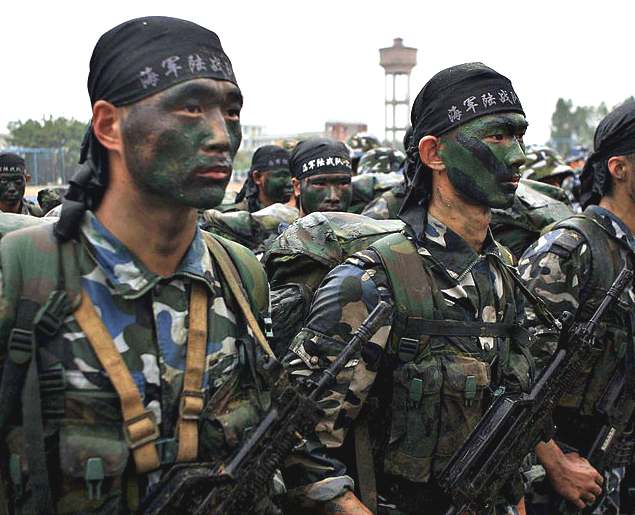
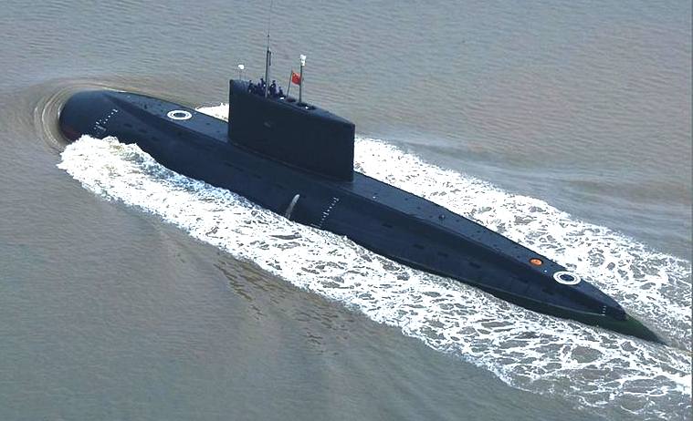
CHINESE NAVY 2013
China will stick to the path of peaceful development yet “in no way will the country abandon its legitimate rights and interests, nor will it give up its core national interests,” Xi said.
PEOPLES LIBERATION ARMY NAVY
The People's Liberation Army Navy (PLAN or PLA Navy) is the naval warfare branch of the People's Liberation Army, the armed forces of the People's Republic of China. The navy can trace its lineage to naval units fighting during the Chinese Civil War and was established during the September of 1950. Throughout the 1950s and early 1960s the Soviet Union provided assistance to the PLAN in the form of naval advisers and export of equipment and
technology. Until the late 1980s, the PLAN was largely a riverine and littoral force (Brown-water navy), however by the 1990s, following the fall of the Soviet Union and a shift towards more out-looking attitudes, leaders were freed from worrying over land border disputes, and instead turned its attention towards the seas. This led to the development of the People's Liberation Army Navy into the Green-water navy it is today. Before the 1990s the PLAN had traditionally played a subordinate role to the People's Liberation Army Ground Force.
Reference resources:
LINKS:
http://www.bloomberg.com/news/2013-08-01/xi china navy boost
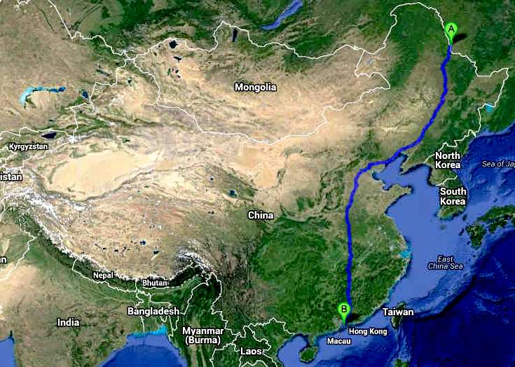
AI HUI QU - SHENZEN: TRANS-CHINA CANNONBALL ZEV RUN STOPS* 50mph
A new World series of ZEV events: The Cannonball International series for serious eco warriors only. Entry to these events are free, provided that the Rules are followed (for you own safety). The objective is to demonstrate that transport can be pollution free. The Trans-China route is extremely demanding, hence is suggested only for the most experienced cross country drivers.
Solar Cola drinkers care about planet earth
.. Thirst for Life
(330ml Planet Earth can)
|
|||||||||||||||||||||||||||||||||||||||||||||||||||||||||||||||||||||||||||||||||||||||||||||||||||||||||||||||||||||||||||||||||||||||||||||||||||||||
|
This website is Copyright © 1999 & 2024 Max Energy Limited an educational charity working hard for world peace. The bird logos and names Solar Navigator, Blueplanet Ecostar and Utopia Tristar are trademarks. All rights reserved. All other trademarks are hereby acknowledged.
|


