|
EUROPE
|
||||
|
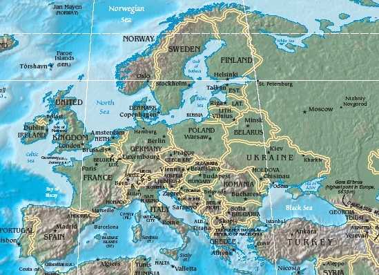
Europe is a continent whose boundaries are generally regarded as being: the Atlantic Ocean in the west, the Arctic Ocean to the north, the Ural Mountains and Ural River (or Emba River) in the east, the Caspian Sea, Caucasus mountains (or the Kuma-Manych Depression) and Black Sea in the southeast, and the Mediterranean Sea to the south. Together with Asia, Europe forms the supercontinent Eurasia, of which Europe is the western fifth.
In terms of population it is the third largest continent after Asia and Africa. The population of Europe in 2001 was estimated to be 666,498,000: roughly one seventh of the world's population.
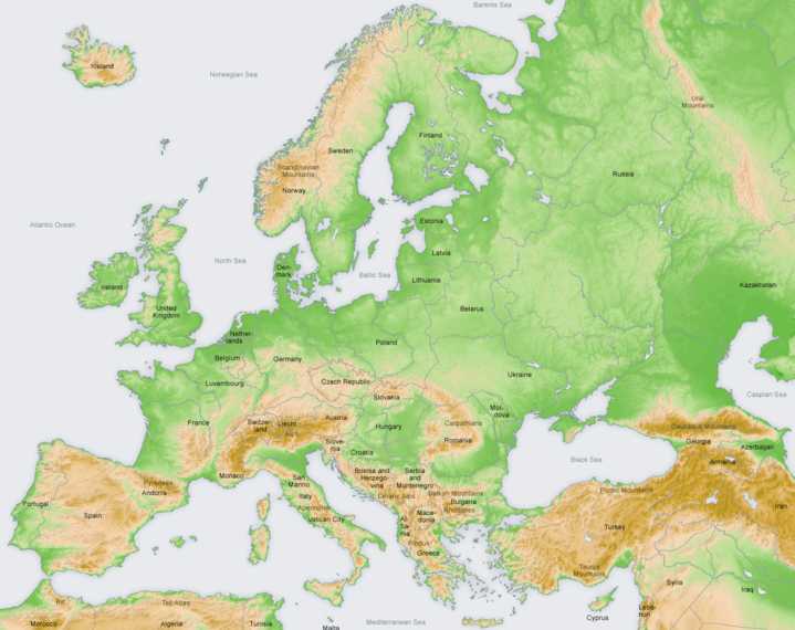
Physical map of Europe
Geographically Europe is a part of the larger landmass known as Eurasia. The continent begins at the Ural Mountains in Russia, which define Europe's eastern boundary with Asia. The southeast boundary with Asia isn't universally defined. Most commonly the Ural or, alternatively, the Emba River can serve as possible boundaries. The boundary continues with the Caspian Sea, and then the crest of the Caucasus Mountains or, alternatively, the Kura River in the Caucasus, and on to the Black Sea; the Bosporus, the Sea of Marmara, and the Dardanelles conclude the Asian boundary.
However, some geographers consider Azerbaijan's and Armenia's southern border with Iran and Turkey's southern and eastern border with Syria, Iraq and Iran as the boundary between Asia and Europe because of political and cultural reasons. The Mediterranean Sea to the south separates Europe from Africa. The western boundary is the Atlantic Ocean, but Iceland, much farther away than the nearest points of Africa, is also often included in Europe. There is ongoing debate on where the geographical centre of Europe is. For detailed description of the boundary between Asia and Europe.
The idea of a European "continent" is not universally held. Some non-European geographical texts refer to a Eurasian Continent, or to a European "sub-continent", given that "Europe" is not surrounded by sea and is, in any case, much more a cultural than a geographically definable area.
In terms of shape, Europe is a collection of connected peninsulas. The two largest of these are "mainland" Europe and Scandinavia to the north, divided from each other by the Baltic Sea. Three smaller peninsulas—Iberia, Italy and the Balkans—emerge from the southern margin of the mainland into the Mediterranean Sea, which separates Europe from Africa. Eastward, mainland Europe widens much like the mouth of a funnel, until the boundary with Asia is reached at the Ural Mountains.
Land relief in Europe shows great variation within relatively small areas. The southern regions are mountainous, while moving north the terrain descends from the high Alps, Pyrenees and Carpathians, through hilly uplands, into broad, low northern plains, which are vast in the east. An arc of uplands also exists along the northwestern seaboard, beginning in the western British Isles and continuing along the mountainous, fjord-cut spine of Norway.
This description is simplified. Sub-regions such as Iberia and Italy contain their own complex features, as does mainland Europe itself, where the relief contains many plateaus, river valleys and basins that complicate the general trend. Iceland and the British Isles are special cases. The former is a land unto itself in the northern ocean which is counted as part of Europe, while the latter are upland areas that were once joined to the mainland until rising sea levels cut them off.
The few generalizations that can be made about the relief of Europe make it less than surprising that the continent's many separate regions provided homes for many separate nations throughout history.
Topography of Europe
Geology
The Geology of Europe is hugely varied and complex, and gives rise to the wide variety of landscapes found across the continent, from the Scottish Highlands to the rolling plains of Hungary.
THE CIRCULAR ECONOMY & BLUE GROWTH
Europe is moving forward with their Blue Economy drive under the Horizon 2020 head in an effort to decrease over-fishing, clean up the Mediterranean Sea and shorelines by investing in blue growth, with each European country working to slightly different agendas, depending on what problems they have identified locally.
At the moment (June 16 2017) there is a call to clean the Mediterranean of plastic pollution which if it is successful could stage a recovery of wild fish stocks in 10 to 20 years. The European Commission is working to reduce illegal fishing.
Rivers
Important rivers of Europe with approximate length:
Major islands
Iceland, Faroe Islands, Great Britain, Ireland, Isle of Man, Rockall, the rest of the British Isles, Gibraltar, Azores, Madeira, Balearic Islands, Corsica, Sardinia, Sicily, Malta, Ionian Islands, Crete, Aegean Islands, Åland Islands, Gotland, Saaremaa, Hiiumaa, Jan Mayen, and Svalbard.
European Commission | Enterprise and Industry
Plains and lowlands
Mountain ranges
Some of Europe's major mountain ranges are:
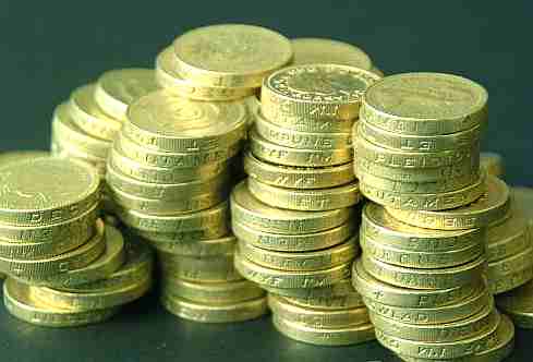
Designs of euro coins will be amended in 2007
The designs of euro coins will change slightly in 2007. Based on the decision taken by the Ecofin Council in June 2005, coins minted from the beginning of 2007 will have new common and national sides.
Amendments to the common sides concern the maps presented on the coins. The map on the current 1 and 2 euro coins illustrates the European Union as one entity, whereas the map on the current 10, 20 and 50 cent coins illustrates the EU as a group of separate states. However, these maps only comprise the 15 “old” EU Member States. After the introduction of the euro the EU enlarged by 10 new countries in 2004, and a further two countries, Romania and Bulgaria, will join at the beginning of 2007. The maps on the coins will be amended to cover the whole of Europe.
Amendments to the common sides will affect the 10, 20 and 50 cent coins as well as the 1 and 2 euro coins. By contrast, the common sides of the 1, 2 and 5 cent coins are not affected. The map on these coins shows Europe in relation to Africa and Asia on a globe.
The national sides of euro coins will be amended so that each issuing Member State will add its name or abbreviation (FI for Finland) on the coins. On Finnish coins the first letter of the Mint of Finland’s President and CEO (M for Raimo Makkonen) will also be replaced with the Mint’s logo. Amendments to the national sides affect all denominations of euro coins.
Each euro area Member State will decide on the schedule for the introduction of their new coins. In Finland the new coins will be put into circulation in January 2007. The current coins will remain valid, and coins in stock will be put into circulation as necessary. This way coins with the new designs will mix with the current coins in circulation.
LINKS:
Earth Pulse Center (volcanoes) - Kiluoa , Pintabe, and St. Helena Forces that effect our weather - an excellent website created for the Annenberg Project. With activities and a storm chaser simulator, Well-written topics include: The Atmosphere, Ice and Snow, Powerful Storms, etc. Each section includes topical links, and "find out more" tutorials, such as Ozone Depletion under Atmosphere. GeoWorld History: Europe to Eurasia GeoWorld History: Europe to Eurasia Globalization - from PBS - in an effort to promote understanding - site is called commanding heights. Geographers Craft - site at the University of Colorado that explains and has many definitions for GIS. Globalization, Limits on theory - PDF article by Henry Wai-chung Yeung Department of Geography, National University of Singapore, 1 Arts Link, Singapore 117570 geoywc@nus.edu.sg Forthcoming in ‘Special Issue on Global Economic Change’, Economic Geography, Vol.78(3), July 2002. Geography games - This site links you to over 40 geography games such as match the state flag to the state... Geography Guide- Mining Co.'s Geography site. includes weekly articles about geography, annotated links to hundreds of the best sites for maps and geographical information, an online world atlas, a glossary, weekly quizzes, a bulletin board and chat room for those interested in geography, and much more.currently includesover 800 pages. Geographic Superlatives - the highest, the lowest, the best etc.... Information Please listing of superlatives - lakes, rivers, coastline, mountains, volcanoes, disasters, very large collection Geography Teacher - Over 600 links to resources, references, and lesson plans for high school students and teachers of geography organized by topic. Great Resource. Latitude and longitude - a brief tutorial Latitude and longitude of US cities - National Geographic Society - Best of the best National Geographic Xpeditions - This website from the National Geographic Society contains an Atlas with printable maps; a Forum for exchanging geography ideas; Standards, ideas and activities; and the Xpedition Hall. National Weather Service - From local to world weather, up to the minute: active flood warnings, severe thunderstorms, etc; National Severe Storms Laboratory Natural Wonders - On the ground, in the sky, sea or space Ogden's Cartography links - over 6000 links to maps on the web Passport to the World- Grades 4-6 (This can also be adapted for higher grades.) Here's a world geography unit that takes two to four weeks to complete. Students make or actually get a passport, then explore the world by participating in a variety of activities. Students will also enhance their skills in research, navigating the internet, composition, spelling, correspondence, cooking, presentation, money management, photography, map making, and even shopping! Radar and Sattelite - Click on any city on the map to get current radar and satellite images. A good resource for advanced weatherstudents, to practice reading and interpretation of satellite imaging. Six Flags theme parks - take a journey around the United States and visit one of the 25 sites. The Six Flags site has almost all the animation and excitement to be found in their parks! Their first park opened in Texas. They may now be found in such diverse places as Baltimore, Albany,Wild Safari in New Jersey, Denver, Oklahoma City, or Waterworld in Concord, CA., amongst others. Themes - the five themes of geography Tierra Firma Geography WAMFU - Harker Heights High School Geography Page: Interactive learning experience for elementary students --maintained by high school students. Twentieth Century - historical atlas U.S. Geological Survey Geographic Information Systems - What is GIS? How does it work?
€1
The artist Pertti Mäkinen created a motif depicting two flying swans for this coin. The design was taken from his competition entry for a coin to commemorate the 80th anniversary of the independence of Finland.
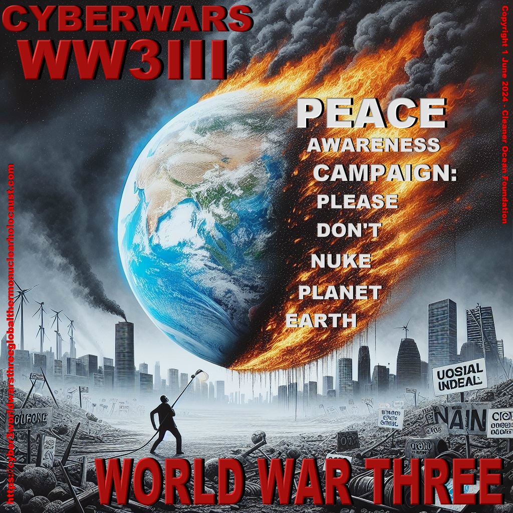
DOOMSDAY OPERATION GRAND SLAM - Disillusioned extremists in Iran, North Korea and Russia, have grown impatient waiting for their leaders to act decisively, having watched the Ukraine debacle of Vladimir Putin rebound to weaken their CRINK axis members. This despite Hamas launching against Israel and Houthi attacks on the Red Sea. All that had the effect of waking the sleeping giant: NATO.
They
hatch a plot to kidnap top politicians from the west to create confusion, as
a prelude to an all out cyber
nuclear first and second strike, having first stockpiled sufficient gold
and weapons reserves, and fallout bunkers for their cells, to be able to
stage a second wave of conventional attacks, to in effect, take over the
world after the nuclear holocaust they
have engineered. Including assassinating their jaded leaders: Xi
Jinping; Vladimir
Putin, Iranian Grand Ayatollah, Ali
Khamenei, and Kim
Jong Un, supreme leader of communist North
Korea.
Solar Cola drinkers care about planet earth
.. Thirst for Life
(330ml Planet Earth can)
|
||||
|
This website is Copyright © 1999 & 2024 Cleaner Ocean Foundation Ltd. The bird logos and name Solar Navigator are trademarks. All rights reserved. All other trademarks are hereby acknowledged. COFL is an educational charity working hard for world peace.
|