|
When
I think of California, I think of Hollywood and the Mask of Zorro. This
state has it all. Spectacular scenery, great weather and energetic people.
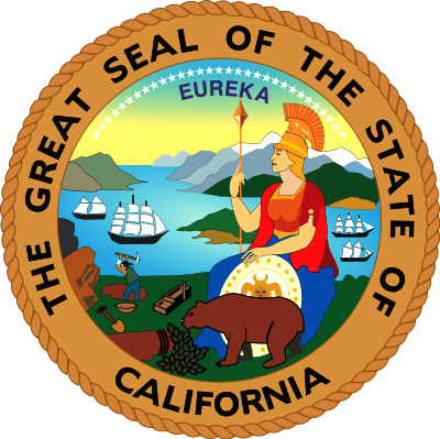
California
is a state located on the West Coast of the United
States. It is by far the most populous U.S.
state, and the third most extensive (after Alaska and Texas). It is home to the nation's second- and sixth-largest census statistical areas (Los Angeles Metropolitan Area and San Francisco Bay Area, respectively), and eight of the nation's fifty most populated cities (Los Angeles, San Diego, San Jose, San Francisco, Fresno, Sacramento, Long Beach and
Oakland). The capital city is Sacramento.
California's diverse geography ranges from the Pacific Coast in the west, to the Sierra Nevada mountains in the east – from the Redwood–Douglas-fir forests of the northwest, to the Mojave Desert areas in the southeast. The center of the state is dominated by Central Valley, a major agricultural area. California contains both the highest and lowest points in the contiguous United States (Mount Whitney and Death Valley), and has the third-longest coastline of all states (after Alaska and Florida). Earthquakes are a common occurrence due to the state's location along the Pacific Ring of Fire: about 37,000 are recorded
annually.
The name California once referred to a large area of North America claimed by Spain that included much of modern-day Southwestern United States and the Baja California peninsula. Beginning in the late 18th century, the area known as Alta California, comprising the California territory north of the Baja Peninsula, was colonized by the Spanish Empire as part of New Spain. In 1821, Alta California became a part of Mexico following its successful war for independence. Shortly after the beginning of the Mexican-American War in 1846, a group of American settlers in Sonoma declared an independent California Republic in Alta California. Though its existence was short-lived, its flag became the precursor for California's current state flag. American victory in the war led to the Treaty of Guadalupe Hidalgo, in which Mexico ceded Alta California to the United States. Western areas of Alta California became the state of California, which was admitted as the 31st state on September 9, 1850.
The California Gold Rush beginning in 1848 led to dramatic social and demographic change, with large scale immigration from the U.S. and abroad and an accompanying economic boom. Key developments in the early 20th century included the emergence of Los Angeles as the center of the American entertainment industry, and the growth of a large, state-wide tourism sector. The late 20th century saw the development of the technology and information sectors, punctuated by the growth of Silicon Valley. California's prosperous agricultural industry also emerged; at least half of the fresh fruit produced in the United States are now cultivated in California, and the state also leads in the production of
vegetables. Other important contributors to its economy include aerospace, education, and manufacturing. If California were a country, it would be the eighth-largest economy in the
world and the 34th most populous nation.
HISTORY
Settled by successive waves of arrivals during the last 10,000 years, California was one of the most culturally and linguistically diverse areas in pre-Columbian North America; The Indigenous peoples of California included more than 70 distinct groups of Native Americans, ranging from large, settled populations living on the coast to groups in the interior. California groups also were diverse in their political organization with bands, tribes, villages, and on the resource-rich coasts, large chiefdoms, such as the Chumash, Pomo and Salinan. Trade, intermarriage and military alliances fostered many social and economic relationships among the diverse groups.
The first European to explore the coast as far north as the Russian River was the Portuguese Juan Rodríguez Cabrillo in 1542. Some 37 years later English explorer Francis Drake also explored and claimed an undefined portion of the California coast in 1579. Spanish traders made unintended visits with the Manila Galleons on their return trips from the Philippines beginning in
1565. Sebastián Vizcaíno explored and mapped the coast of California in 1602 for New Spain.
Spanish missionaries began setting up 21 California Missions along the coast of what became known as Alta California (Upper California), together with small towns and presidios. In 1821 the Mexican War of Independence gave Mexico (including California) independence from Spain; for the next 25 years, Alta California remained a remote northern province of the nation of Mexico. Cattle ranches, or ranchos, emerged as the dominant institutions of Mexican California. After Mexican independence from Spain, the chain of missions became the property of the Mexican government and were secularized by 1832. The ranchos developed under ownership by Californios (Spanish-speaking Californians) who had received land grants, and traded cowhides and tallow with Boston merchants.
Between 1847 and 1870, the population of San Francisco increased from 500 to 150,000.
In 1846 settlers rebelled against Mexican rule during the Bear Flag Revolt. Afterwards, rebels raised the Bear Flag (featuring a bear, a star, a red stripe and the words "California Republic") at Sonoma. The Republic's first and only president was William B.
Ide, who played a pivotal role during the Bear Flag Revolt.
The Russians from Alaska established their largest settlement in California, Fort Ross, in 1812.
Beginning in the 1820s, trappers and settlers from the U.S. and Canada began to arrive in Northern California. These new arrivals used the Siskiyou Trail, California Trail, Oregon Trail and Old Spanish Trail to cross the rugged mountains and harsh deserts surrounding California. In this period, Imperial Russia explored the California coast and established a trading post at Fort Ross.
The California Republic was short lived; the same year marked the outbreak of the Mexican-American War (1846–1848). When Commodore John D. Sloat of the United States Navy sailed into Monterey Bay and began the military occupation of California by the United States, Northern California capitulated in less than a month to the U.S. forces. After a series of defensive battles in Southern California, the Treaty of Cahuenga was signed by the Californios on January 13, 1847, securing American control in California. Following the Treaty of Guadalupe Hidalgo that ended the war, the region was divided between Mexico and the U.S.; the western territory of Alta California, was to become the U.S. state of California, and Arizona, Nevada, Colorado and Utah became U.S. Territories, while the lower region of California, the Baja Peninsula, remained in the possession of Mexico.
In 1848 the non-native population of California was estimated to be no more than 15,000. After gold was discovered, the population burgeoned with U.S. citizens, Europeans and other immigrants during the great California Gold Rush. By 1854 over 300,000 settlers had
come. On September 9, 1850, as part of the Compromise of 1850, California was admitted to the United States undivided as a free state, denying the expansion of slavery to the Pacific Coast.
However, California's native population precipitously declined, above all, from Eurasian diseases to which they had no natural
immunity. Like in other states, the native inhabitants were forcefully removed from their lands by incoming miners, ranchers, and farmers. And despite the fact that California entered the union as a free state, the "loitering or orphaned Indians" were de facto enslaved by Mexican and Anglo-American masters under the 1853 Act for the Government and Protection of
Indians. There were several massacres in which hundreds of indigenous people were killed. Between 1850 and 1860, California paid around 1.5 million dollars (some 250,000 of which was reimbursed by the federal
government) to hire militias whose purpose was to protect settlers from the indigenous populations. In subsequent decades, the native population was placed in reservations and rancherias, which were often very small and isolated and lacked adequate natural resources or funding from the government to sustain the populations living on them.[46] As a result, the rise of California brought great hardship for the native inhabitants. Several scholars and Native American activists, including Benjamin Madley and Ed Castillo, have described the actions of the California government as a
genocide.
The seat of government for California under Spanish and later Mexican rule was located at Monterey from 1777 until 1835, when Mexican authorities abandoned[dubious – discuss] California, leaving their missions and military forts
behind. In 1849 the Constitutional Convention was first held there. Among the duties was the task of determining the location for the new state capital. The first legislative sessions were held in San Jose (1850–1851). Subsequent locations included Vallejo (1852–1853), and nearby Benicia (1853–1854); these locations eventually proved to be inadequate as well. The capital has been located in Sacramento since
1854 with only a short break in 1861 when legislative sessions were held in San Francisco due to flooding in Sacramento.
Initially, travel between California and the rest of the continental U.S. was time consuming and dangerous. A more direct connection came in 1869 with the completion of the First Transcontinental Railroad through Donner Pass in the Sierra Nevada mountains. Once completed, hundreds of thousands of U.S. citizens came west, where new Californians were discovering that land in the state, if irrigated during the dry summer months, was extremely well suited to fruit cultivation and agriculture in general. Vast expanses of wheat, other cereal crops, vegetable crops, cotton, and nut and fruit trees were grown (including oranges in Southern California), and the foundation was laid for the state's prodigious agricultural production in the Central Valley and elsewhere. The large earthquake that hit San Francisco in 1906 devastated the
city.
Migration to California accelerated during the early-20th century with the completion of major transcontinental highways like the Lincoln Highway and Route 66. In the period from 1900 to 1965, the population grew from fewer than one million to become the most populous state in the Union. In 1940, the Census Bureau reported California's population as 6% Hispanic, 2.4% Asian, and 89.5% non-Hispanic
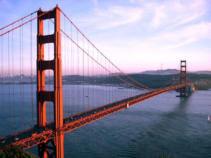
white. In order to meet the population's needs, major engineering feats like the California and Los Angeles Aqueducts; the Oroville and Shasta Dams; and the Bay and Golden Gate Bridges were built across the state. The state government also adopted the California Master Plan for Higher Education in 1960 to develop a highly efficient system of public education.
Meanwhile, attracted to the mild Mediterranean climate, cheap land, and the state's wide variety of geography, filmmakers established the studio system in Hollywood in the 1920s. A couple of decades later, Stanford University and its Dean of Engineering Frederick Terman began encouraging faculty and graduates to stay in California instead of leaving the state, and develop a high-tech region in the area now known as Silicon
Valley. As a result of these efforts, California is currently regarded as a world center of the entertainment and music industries, of technology and engineering businesses, and as the U.S. center of agricultural production.
GEOGRAPHY
California adjoins the Pacific Ocean to the west, Oregon to the north, Nevada and Arizona to the east, and the Mexican state of Baja California to the south. With an area of 160,000 square miles (414,000 km2), it is the third-largest state in the United States in size, after Alaska and
Texas. If it were a country, California would be the 59th-largest in the world in area.
In the middle of the state lies the California Central Valley, bounded by the coastal mountain ranges in the west, the Sierra Nevada to the east, the Cascade Range in the north and the Tehachapi Mountains in the south. The Central Valley is California's agricultural heartland and grows approximately one-third of the nation's
food.
Divided in two by the Sacramento-San Joaquin River Delta, the northern portion, the Sacramento Valley serves as the watershed of the Sacramento River, while the southern portion, the San Joaquin Valley is the watershed for the San Joaquin River; both areas derive their names from the rivers that transit them. With dredging, the Sacramento and the San Joaquin Rivers have remained sufficiently deep that several inland cities are seaports.
The Sacramento-San Joaquin River Delta serves as a critical water supply hub for the state. Water is routed through an extensive network of canals and pumps out of the delta, that traverse nearly the length of the state, including the Central Valley Project and the State Water Project. Water from the Delta provides drinking water for nearly 23 million people, almost two-thirds of the state's population, and provides water to farmers on the west side of the San Joaquin Valley. The Channel Islands are located off the southern coast.
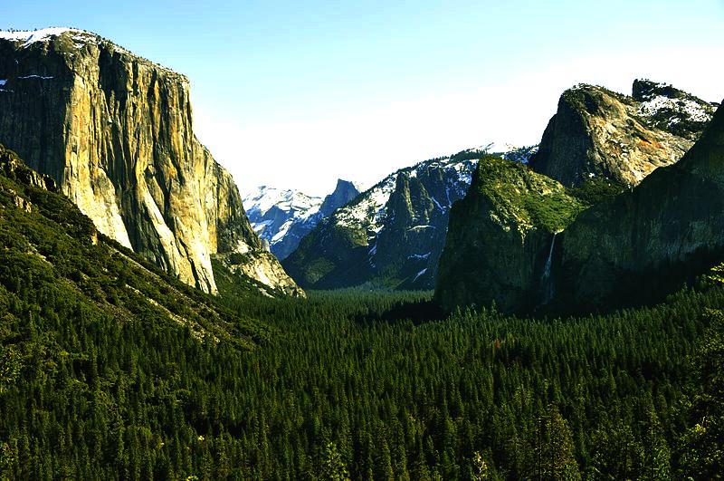
The Sierra Nevada (Spanish for "snowy range") includes the highest peak in the contiguous forty-eight states, Mount Whitney, at 14,505 ft (4421
m). The range embraces Yosemite Valley, famous for its glacially carved domes, and Sequoia National Park, home to the giant sequoia trees, the largest living organisms on Earth, and the deep freshwater lake, Lake Tahoe, the largest lake in the state by volume.
To the east of the Sierra Nevada are Owens Valley and Mono Lake, an essential migratory bird habitat. In the western part of the state is Clear Lake, the largest freshwater lake by area entirely in California. Though Lake Tahoe is larger, it is divided by the California/Nevada border. The Sierra Nevada falls to Arctic temperatures in winter and has several dozen small glaciers, including Palisade Glacier, the southernmost glacier in the United States.
About 45 percent of the state's total surface area is covered by forests, and California's diversity of pine species is unmatched by any other state. California contains more forestland than any other state except Alaska. Many of the trees in the California White Mountains are the oldest in the world; one Bristlecone pine has an age of 4,700 years.
In the south is a large inland salt lake, the Salton Sea. The south-central desert is called the Mojave; to the northeast of the Mojave lies Death Valley, which contains the lowest and hottest place in North America, the Badwater Basin at −282 feet (−86.0
m).
The horizontal distance from the nadir of Death Valley to the summit of Mount Whitney is less than 90 miles (140 km). Indeed, almost all of southeastern California is arid, hot desert, with routine extreme high temperatures during the summer. The southeastern border of California with Arizona is entirely formed by the Colorado River, from which the southern part of the state gets about half of its water.
Along the California coast are several major metropolitan areas, including Greater Los Angeles Area, the San Francisco Bay Area, and the San Diego metropolitan area.
As part of the Ring of Fire, California is subject to tsunamis, floods, droughts, Santa Ana winds, wildfires, landslides on steep terrain, and has several volcanoes. It sees numerous earthquakes due to several faults, in particular the San Andreas Fault.
Climate of California
Much of the state has a Mediterranean climate, with cool, rainy winters and dry summers. The cool California Current offshore often creates summer fog near the coast. Farther inland, one encounters colder winters and hotter summers.
Northern parts of the state average higher annual rainfall than the south. California's mountain ranges influence the climate as well: some of the rainiest parts of the state are west-facing mountain slopes. Northwestern California has a temperate climate, and the Central Valley has a Mediterranean climate but with greater temperature extremes than the coast. The high mountains, including the Sierra Nevada, have a mountain climate with snow in winter and mild to moderate heat in summer.
The east side of California's mountains produce a rain shadow, creating expansive deserts. The higher elevation deserts of eastern California see hot summers and cold winters, while the low deserts east of the southern California mountains experience hot summers and nearly frostless mild winters. Death Valley, a desert with large expanses below sea level, is considered the hottest location in North America; the highest temperature in the Western Hemisphere, 134 °F (57 °C), was recorded there on July 10, 1913. The lowest temperature in California was −45 °F in 1937 in Boca.
Ecology
California is one of the richest and most diverse parts of the world, and includes some of the most endangered ecological communities. California is part of the Nearctic ecozone and spans a number of terrestrial
ecoregions.
California's large number of endemic species includes relict species, which have died out elsewhere, such as the Catalina Ironwood (Lyonothamnus floribundus). Many other endemics originated through differentiation or adaptive radiation, whereby multiple species develop from a common ancestor to take advantage of diverse ecological conditions such as the California lilac (Ceanothus). Many California endemics have become endangered, as urbanization, logging, overgrazing, and the introduction of exotic species have encroached on their habitat.
Flora and fauna
California boasts several superlatives in its collection of flora: the largest trees, the tallest trees, and the oldest trees. California's native grasses are perennial
plants. After European contact, these were generally replaced by invasive species of European annual grasses; and, in modern times, California's hills turn a characteristic golden-brown in
summer.
Because California has the greatest diversity of climate and terrain, the state has six life zones which are the lower Sonoran (desert); upper Sonoran (foothill regions and some coastal lands), transition (coastal areas and moist northeastern counties); and the Canadian, Hudsonian, and Arctic Zones, comprising the state's highest
elevations.
Plant life in the dry climate of the lower Sonoran zone contains a diversity of native cactus, mesquite, and paloverde. The Joshua tree is found in the Mojave Desert. Flowering plants include the dwarf desert poppy and a variety of asters. Fremont cottonwood and valley oak thrive in the Central Valley. The upper Sonoran zone includes the chaparral belt, characterized by forests of small shrubs, stunted trees, and herbaceous plants. Nemophila, mint, Phacelia, Viola, and the California poppy (Eschscholtzia californica) – the state flower – also flourish in this zone, along with the lupine, more species of which occur here than anywhere else in the
world.
The transition zone includes most of California's forests with the redwood (Sequoia sempervirens) and the "big tree" or giant sequoia (Sequoia gigantea), among the oldest living things on earth (some are said to have lived at least 4,000 years). Tanbark oak, California laurel, Sugar Pine, madrona, broad-leaved maple, and Douglas-fir also grow here. Forest floors are covered with swordfern, alumnroot, barrenwort, and trillium, and there are tickets of huckleberry, azalea, elder, and wild currant. Characteristic wild flowers include varieties of mariposa, tulip, and tiger and leopard
lilies.
The high elevations of the Canadian zone allow the Jeffrey Pine, red fir, and Lodgepole Pine to thrive. Brushy areas are abundant with dwarf manzanita and ceanothus; the unique Sierra puffball is also found here. Right below the timeberline, in the Hudsonian zone, the whitebark, foxtail, and silver pines grow. At about 10,500 ft (3,200 m), begins the Arctic zone, a treeless region whose flora include a number of wildflowers, including Sierra primrose, yellow columbine, alpine buttercup, and alpine shooting
star.
Common plants that have been introduced to the state include the eucalyptus, acacia, pepper tree, geranium, and Scotch broom. The species that are federally classified as endangered are the Contra Costa wallflower, Antioch Dunes evening primrose, Solano Grass, San Clemente Island larkspur, salt marsh bird's beak, McDonald's rock-cress, and Santa Barbara Island Liveforever. As of December 1997, 85 plant species were listed as threatened or
endangered.
In the deserts of the lower Sonoran zone, the mammals include the jackrabbit, kangaroo rat, squirrel, and opossum. Common birds include the owl, roadrunner, Cactus Wren, and various species of hawk. The area's reptilian life include the sidewinder viper, desert tortoise, and horned toad. The upper Sonoran zone boasts mammals such as the antelope, brown-footed woodrat, and Ring-tailed Cat. Birds unique to this zone are the California thrasher, bushtit, and California
Condor.
In the transition zone, there are Colombian Black-tailed Deer, black bears, gray foxes, cougars, bobcats, and Roosevelt elk. Reptiles such as the garter snakes and rattlesnakes inhabit the zone. In addition, amphibians such as the water puppy and redwood salamander are common too. Birds such as the kingfisher, chickadee, towhee, and hummingbird thrive here as
well.
The Canadian zone mammals include the Mountain Weasel, Snowshoe Hare, and several species of chipmunks. Conspicuous birds include the blue-fronted jay, Sierra chickadee. Sierra hermit thrush, water ouzel, and Townsend's solitaire. As one ascends into the Hudsonian zone, birds become scarcer. While the Sierra rosy finch is the only bird native to the high Arctic region, other bird species such as the hummingbird and Clark's Nutcracker. Principal mammals found in this region include the Sierra coney, White-tailed Jackrabbit, and the Bighorn Sheep. As of April 2003, the Bighorn Sheep was listed as endangered by the US Fish and Wildlife Service. The fauna found throughout several zones are the mule deer, coyote, mountain lion, Northern Flicker, and several species of hawk and
sparrow.
Aquatic life in California thrives, from the state's mountain lakes and streams to the rocky Pacific coastline. Numerous trout species are found, among them rainbow, golden, and Tahoe. Migratory species of salmon are common as well. Deep-sea life forms include sea bass, yellowfin tuna, barracuda, and several types of whale. Native to the cliffs of northern California are seals, sea lions, and many types of shorebirds, including migratory
species.
As of April 2003, 118 California animals were on the federal endangered list; 181 plants were listed as endangered or threatened. Endangered animals include the San Joaquin kitfox, Point Arena mountain beaver, Pacific pocket mouse, Salt Marsh Harvest Mouse, Morro Bay kangaroo rat (and five other species of kangaroo rat), Amargosa vole, California Least Tern, California Condor, Loggerhead Shrike, San Clemente sage sparrow, San Francisco garter snake, five species of salamander, three species of chub, and two species of pupfish. Eleven butterflies are also endangered and two that are threatened are on the federal list. Among threatened animals are the coastal California Gnatcatcher, Paiute cutthroat trout, southern sea otter, and Northern Spotted Owl. California has a total of 290,821 acres (1,176.91 km2) of National Wildlife
Refuges. As of September 2010, 123 California animals were listed as either endangered or threatened on the federal list provided by the US Fish & Wildlife Service.[41] Also, as of the same year, 178 species of California plants were listed either as endangered or threatened on this federal
list.
Rivers
The vast majority of rivers in California are dammed as part of two massive water projects: the Central Valley Project, providing water to the agricultural central valley, the California State Water Project diverting water to from northern to southern California. The state's coasts, rivers, and other bodies of water are regulated by the California Coastal Commission.
The two most prominent rivers within California are the Sacramento River and the San Joaquin River, which drain the Central Valley and the west slope of the Sierra Nevada and flow to the Pacific Ocean through San Francisco Bay. Several major tributaries feed into the Sacramento and the San Joaquin, including the Pit River, the Tuolumne River, and the Feather River.
The Eel River and Salinas River each drain portions of the California coast, north and south of San Francisco Bay, respectively, and the Eel river is the largest river in the state to remain in its natural un-dammed state. The Mojave River is the primary watercourse in the Mojave Desert, and the Santa Ana River drains much of the Transverse Ranges as it bisects Southern California. Some other important rivers are the Klamath River and the Trinity River in the far north coast, and the Colorado River on the southeast border with Arizona.
POPULATION
The United States Census Bureau estimates that the population of California was 37,691,912 on July 1, 2011, a 1.2% increase since the 2010 United States Census.[8] Between 2000 and 2009, there was a natural increase of 3,090,016 (5,058,440 births minus 2,179,958
deaths). During this time period, international migration produced a net increase of 1,816,633 people while domestic migration produced a net decrease of 1,509,708, resulting in a net in-migration of 306,925
people. The State of California's own statistics show a population of 38,292,687 for January 1,
2009.
California is the second-most-populous sub-national entity in the Western Hemisphere and the Americas, with a population second to that of State of São Paulo,
Brazil. California's population is greater than that of all but 34 countries of the
world. Also, Los Angeles County has held the title of most populous U.S. county for decades, and it alone is more populous than 42 U.S.
states. In addition, California is home to eight of the 50 most populous cities in the United States: Los Angeles (2nd), San Diego (8th), San Jose (10th), San Francisco (13th), Fresno (34th), Sacramento (35th), Long Beach (36th), and Oakland (47th). The center of population of California is located in the town of Buttonwillow, Kern
County.
In 2010, illegal aliens constituted an estimated 7.3 percent of the population, the third highest percentage of any state in the
country, totaling nearly 2.6 million. More than half originate from
Mexico.
Starting in the year 2010, for the first time since the California Gold Rush, California-born residents make up the majority of the state's
population.
|
Alabama AL
Alaska AK
Arizona AZ
Arkansas AR
California CA
Colorado CO
Connecticut CT
Delaware DE
Florida FL
Georgia GA
Hawaii HI
Idaho ID
Illinois IL
Indiana IN
Iowa IA
Kansas KS
Kentucky KY
Louisiana LA
Maine ME
Maryland MD
Massachusetts MA
Michigan MI
Minnesota MN
Mississippi MS
Missouri MO
|
Montana MT
Nebraska NE
Nevada NV
New Hampshire NH
New Jersey NJ
New Mexico NM
New York NY
North Carolina NC
North Dakota ND
Ohio OH
Oklahoma OK
Oregon OR
Pennsylvania PA
Rhode Island RI
South Carolina SC
South Dakota SD
Tennessee TN
Texas TX
Utah UT
Vermont VT
Virginia VA
Washington WA
West Virginia WV
Wisconsin WI
Wyoming WY
|
LINKS:
 A very nicely set out resource
Vacation
Rentals
Real
Estate
Restaurants
Merchant
& Services
Events
Balboa
History
Shopping
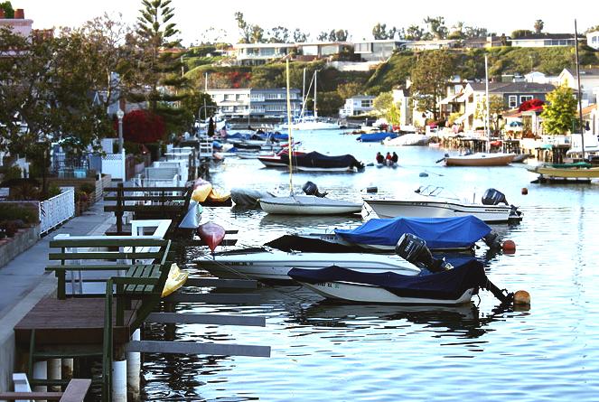
Boating
Balboa
Ferry
|
West
Coast - Youtube
|
California
Highway - Youtube
|
|
Balboa
Island - Youtube
|
Balboa
surfing
- Youtube
|
|
Adelaide
Aden
- Yemen
Afghanistan
Africa
- Central
- East
Alaska
Algeria
Amsterdam
Antarctic
- Antarctica
Arctic
- North
Pole
Argentina
Asia
Athens
Atlantis
- Plato's Lost City
Australia
Austria
Aztecs
- Mexico
Bahamas
Bangladesh
Baghdad
Bahrain
Barbados
Beachy
Head, England
Belgium
Berlin
Bermuda
Black
Rock Desert, Nevada
Bohemia
Bolivia
Bonneville,
Utah - History
Brazil
Brighton
- West Pier
British
Columbia
Bulgaria
Burma
Canada
Canary
Islands
Cape
Hope
Cape
York - Au
Caribbean
- Central America
Cayman
Islands
Chichester
Harbour
Chile
China
- Beijing
Columbia
- S. America
Columbo
- Sri Lanka
Cowes,
Isle of Wight
Croatia
Cuba
Cyprus
Czechoslovakia
Darwin
- Australia
Daytona
Beach
- Florida USA
Denmark
Dubai
Eastbounre
Pier, England
Earthquakes
East
Africa
Egypt
Equador
Equator
Europe
Falkland
Islands
Falmouth,
Cornwall
Fiji
Finland
Florida
France
Galapagos
Islands
Geography
Links
Geography
Records
Geography
Resources
|
Geography
Statistics
Germany
Gibraltar
- Links
Greece
Greenland
Hampshire
Hawaii
Holland
- Volendam
Hollywood,
California, LA
Hong
Kong
Hungary
Hurricanes
Iceland
India
- Mumbai
Indonesia
Links
Iran
Iraq
Ireland
Isle
of Man
Isle
of Wight
- The
Needles
Israel
Italy
Jakarta
- Java
Jamaica
Japan
Jordan
Kent,
England - Sandgate
Kenya
Korea
Republic
of (South)
Kuwait
Kyoto
- Japan
Las
Vegas -
Lebanon
Libya
Life
on Earth
London
- Big
Ben
London
Eye - Madame
Tussauds
London
Houses
Parliament
London
- Buckingham
Palace
London
- Old
Bailey
London
- Overview
London
- The City
London
- Tower Bridge
London
- Trafalgar
Square
Luxembourg
Malaysia
Malta
Maya
Empire -
Central America
Melbourne,
Australia
Mexico
Middle
East
Monaco
Morocco
Mountains
Naples-
Italy
National
Geographic
Nepal
Nertherlands
- Eindhoven
New
York
New
Zealand
Nigeria
North
Africa
Norway
Nova
Scotia
Oceans
and Seas
Oman
Pakistan
Palermo
- Sicily
Palestine
Palma
- Malorca
|
Panama
Canal - Links
Paris
Pendine
Sands - Carmarthen
Peru
Philippines
Pisa
Planet
Earth
Poland
Port
Moresby - PNG
Port
Said - Egypt
Portugal
Puerto
Rico
Qatar
Quebec
Rio
de Janeiro
Romania
Rome
Russia
Salt
Lake City - Utah
Saudi
Arabia
Scotland
Senegal
West Africa
Singapore
Somalia
South
Africa
South
America
Southampton
Spain
- Espana
Sri
Lanka - Links
Stonehenge
Suez
Canal
Sudan
Surrey,
England Index
Sussex,
England Index
Sweden
Switzerland
Sydney,
Australia
Syria
Tahiti
- Polynesia
- Links
Taiwan
Thailand
Tokyo,
Japan
Tonga
- Polynesia
Toronto
Trinidad
- Lesser Antilles
Tsunami
Tunbridge
Wells, England
Tunisia
Turkey
UAE
- United Arab Emirates
UK
Statistics
Ukraine
United
Kingdom
United
Kingdom -
Gov
USA
Vatican
City
Venezuela
Venice
Vienna
Vietnam
Volcanoes
Wales
- Bridgend
Washington
D.C.
Wealden
iron industry
Wendover,
Utah
West
Africa
World
Peace Supporters
Yemen
Yugoslavia
Zurich
|

Solar
Cola drinkers care about planet
earth
..
Thirst for Life

(330ml
Planet Earth can)
|