|
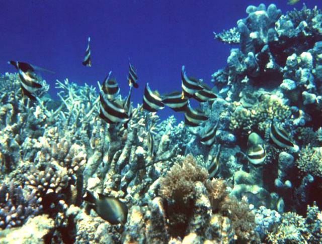
The
sea held a fascinating allure for me, even after seeing Jaws at the Brighton
cinema complex when it was first released. I learned to dive with the
Newhaven branch of the British Sub-Aqua Club and then at Fort Bovisand in
Plymouth. Since then the oceans of the world and the unbelievable variety of
life that it supports has kept my interest and now, like millions of other
people, I'm worried about losing species such as the great whales and the
erosion of the great barrier reef. Much of this is man-made. We (our global
colonisation and hunger for wealth) are responsible for upsetting the
eco-systems that have made life on earth possible. Oceanography is one of
the sciences that monitors what is going on under the waves, so that we
evaluate the harm, or good, that we are causing. Of course we simply need to
know, and we don't. We discover unheard of species every time we take a
closer look. Doesn't that make you wonder? NK
One
of the most pressing concerns at the moment the world over is the growing
plastic content in our oceans that is getting into the food chain. A report
in March of 2015 from the NCEAS in California, puts waste levels as high as
12 million tons, with a mean of 8 million tons. The real issue is that this
is not being tackled by anyone on an urgent basis, save for a robotic
recovery project in the United Kingdom, that is at an early stage in
development and looking for funding to go from a feasibility study to the
build of a fully functional prototype.
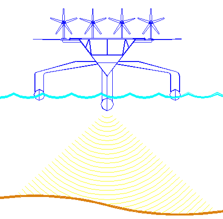
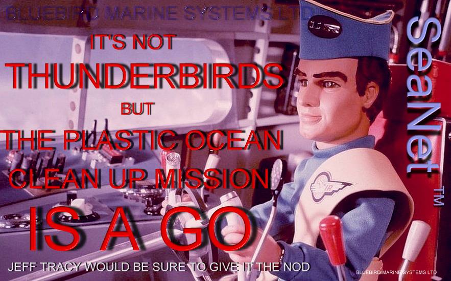
Is
this the solution that we've all been looking for? SeaVax is a giant ocean
going vacuum cleaner designed to suck up plastic waste from the 5, or is
that 6, or maybe even 7 garbage gyres, if we include the newly forming
Arctic gyre and take the North Pacific gyre for what it really is, two separate
swirling bodies. The above is a picture of the feasibility model that was
launched in March of 2015. It is shortly to be fitted with solar panels and
wind turbines, making this robotic craft fully autonomous. You can help
Bluebird Marine Systems to clean up the oceans by telling others about the
project. Please support them if you can. This is essentially a not for
profit project, without assistance from the IMO
or UN as we write. ME
WHAT
IS OCEANOGRAPHY ?
Oceanography (compound of the
Greek words ωκεανός meaning "ocean" and γράφω meaning "to write"), also called oceanology or marine science, is the branch of Earth science that studies the ocean. It covers a wide range of topics, including marine organisms and ecosystem dynamics; ocean currents, waves, and geophysical fluid dynamics; plate tectonics and the geology of the sea floor; and fluxes of various chemical substances and physical properties within the ocean and across its boundaries. These diverse topics reflect multiple disciplines that oceanographers blend to further knowledge of the world ocean and understanding of processes within it: biology, chemistry, geology, meteorology, and physics as well as geography.
HISTORY
Humans first acquired knowledge of the waves and currents of the seas and oceans in pre-historic times. Observations on tides were recorded by Aristotle and Strabo. Early modern exploration of the oceans was primarily for cartography and mainly limited to its surfaces and of the creatures that fishermen brought up in nets, though depth soundings by lead line were taken.
Although Juan Ponce de León in 1513 first identified the Gulf Stream, and the current was well-known to mariners,
Benjamin Franklin made the first scientific study of it and gave it its name. Franklin measured
water temperatures during several Atlantic crossings and correctly explained the Gulf Stream's cause. Franklin and Timothy Folger printed the first map of the Gulf Stream in
1769-1770.
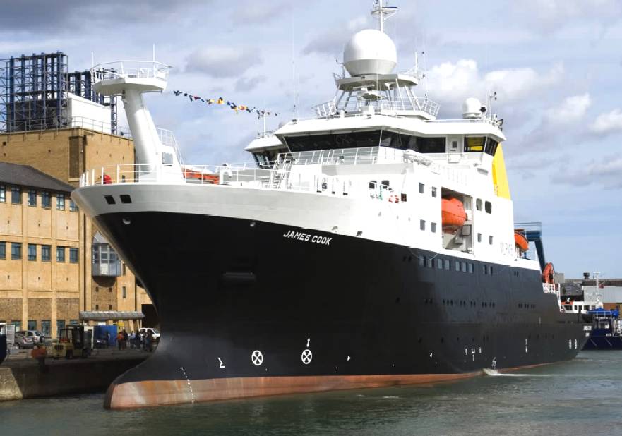
When Louis Antoine de Bougainville, who voyaged between 1766 and 1769, and James
Cook, who voyaged from 1768 to 1779, carried out their explorations in the South Pacific, information on the oceans themselves formed part of the reports. James Rennell wrote the first scientific textbooks about currents in the
Atlantic and
Indian oceans during the late 18th and at the beginning of 19th century. Sir James Clark Ross took the first modern sounding in deep sea in 1840, and
Charles Darwin published a paper on reefs and the formation of atolls as a result of the second voyage of HMS Beagle in 1831-6. Robert FitzRoy published a report in four volumes of the three voyages of the Beagle. In 1841–1842 Edward Forbes undertook dredging in the Aegean Sea that founded marine ecology.
As first superintendent of the United States Naval Observatory (1842–1861) Matthew Fontaine Maury devoted his time to the study of marine meteorology,
navigation, and charting prevailing winds and currents. His Physical Geography of the Sea, 1855 was the first textbook of oceanography. Many nations sent oceanographic observations to Maury at the Naval Observatory, where he and his colleagues evaluated the information and gave the results worldwide
distribution.
The steep slope beyond the continental shelves was discovered in 1849. The first successful laying of transatlantic telegraph cable in August 1858 confirmed the presence of an underwater "telegraphic plateau" mid-ocean ridge. After the middle of the 19th century, scientific societies were processing a flood of new terrestrial botanical and zoological information.
In 1871, under the recommendations of the Royal Society of London, the British government sponsored an expedition to explore world's oceans and conduct scientific investigations. Under that sponsorship the Scots Charles Wyville Thompson and Sir John Murray launched the Challenger expedition (1872–1876). The results of this were published in 50 volumes covering biological, physical and geological aspects. 4417 new species were discovered.
Other European and American nations also sent out scientific expeditions (as did private individuals and institutions). The first purpose built oceanographic ship, the "Albatros" was built in 1882. The four-month 1910 North
Atlantic expedition headed by Sir John Murray and Johan Hjort was at that time the most ambitious research oceanographic and marine zoological project ever, and led to the classic 1912 book The Depths of the Ocean.
Oceanographic institutes dedicated to the study of oceanography were founded. In the United States, these included the Scripps Institution of Oceanography in 1892,
Woods Hole Oceanographic Institution in 1930, Virginia Institute of Marine Science in 1938, Lamont-Doherty Earth Observatory at Columbia
University, and the School of Oceanography at University of Washington. In Britain, there is a major research institution: National Oceanography Centre, Southampton which is the successor to the Institute of Oceanography. In
Australia, CSIRO Marine and Atmospheric Research, known as CMAR, is a leading center. In 1921 the International Hydrographic Bureau (IHB) was formed in
Monaco.
In 1893, Fridtjof Nansen allowed his ship "Fram" to be frozen in the
Arctic ice. As a result he was able to obtain oceanographic data as well as meteorological and astronomical data. The first international organization of oceanography was created in 1902 as the International Council for the Exploration of the Sea.
The first acoustic measurement of sea depth was made in 1914. Between 1925 and 1927 the "Meteor" expedition gathered 70,000 ocean depth measurements using an echo sounder, surveying the Mid atlantic ridge. The Great Global Rift, running along the Mid Atlantic Ridge, was discovered by Maurice Ewing and Bruce Heezen in 1953 while the mountain range under the Arctic was found in 1954 by the
Arctic Institute of the USSR. The theory of seafloor spreading was developed in 1960 by Harry Hammond Hess. The Ocean Drilling Project started in 1966. Deep sea vents were discovered in 1977 by John Corlis and Robert Ballard in the submersible "Alvin".
In 1939 the Carnegie Institution assigned Dr. Charles S. Piggot the mission of exploring the sea bed for Radium deposits. For this deep water mission the Western Union Cable vessel the Lord Kelvin was converted to the ability to lower a cable down several miles, which had a unit attached that fired a hollow dart into the sea bed floor which was then raised with the seabed sample for analysis.
In the 1950s, Auguste Piccard invented the bathyscaphe and used the "Trieste" to investigate the ocean's depths. The nuclear
submarine Nautilus made the first journey under the ice to the North Pole in 1958. In 1962 there was the first deployment of FLIP (Floating Instrument Platform), a 355 foot spar buoy.
Then, in 1966, the U.S. Congress created a National Council for Marine Resources and Engineering Development.
NOAA was put in charge of exploring and studying all aspects of Oceanography in the
USA. It also enabled the National Science Foundation to award Sea Grant College funding to multi-disciplinary researchers in the field of
oceanography.
From the 1970s, there has been much emphasis on the application of large scale
computers to oceanography to allow numerical predictions of ocean conditions and as a part of overall environmental change prediction. An oceanographic buoy array was established in the
Pacific to allow prediction of El Niño events.
1990 saw the start of the World Ocean Circulation Experiment (WOCE) which continued until 2002. Geosat seafloor mapping data became available in 1995.
In 1942, Sverdrup and Fleming published "The Ocean" which was a major landmark. "The Sea" (in three volumes covering physical oceanography, seawater and geology) edited by M.N. Hill was published in 1962 while the "Encyclopedia of Oceanography" by Rhodes Fairbridge was published in 1966.
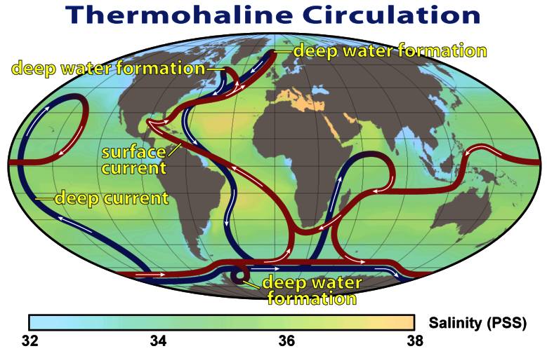
Connection to the
atmosphere
The study of the oceans is linked to understanding global
climate
changes, potential global warming and related biosphere concerns. The atmosphere and ocean are linked because of evaporation and precipitation as well as thermal flux (and solar insolation).
Wind stress is a major driver of ocean currents while the ocean is a sink for atmospheric
carbon dioxide.
Our planet is invested with two great oceans; one visible, the other invisible; one underfoot, the other overhead; one entirely envelopes it, the other covers about two thirds of its surface.
—Matthew F. Maury, The Physical Geography of the Seas and Its Meteorology (1855)

BRANCHES
Oceanographic frontal systems on the Southern HemisphereThe study of oceanography is divided into branches:
-
Biological oceanography, or marine biology, is the study of the plants, animals and microbes of the oceans and their ecological interaction with the ocean;
-
Chemical oceanography, or marine chemistry, is the study of the chemistry of the ocean and its chemical interaction with the atmosphere;
-
Geological oceanography, or marine geology, is the study of the geology of the ocean floor including plate tectonics and
paleoceanography;
Physical oceanography, or marine physics, studies the ocean's physical attributes including temperature-salinity structure, mixing, waves, internal waves, surface tides, internal tides, and currents.
These branches reflect the fact that many oceanographers are first trained in the exact sciences or mathematics and then focus on applying their interdisciplinary knowledge, skills and abilities to
oceanography.
Data derived from the work of Oceanographers is used in marine engineering, in the design and building of oil platforms, ships, harbours, and other structures that allow us to use the ocean
safely.
Oceanographic data management is the discipline ensuring that oceanographic data both past and present are available to researchers.
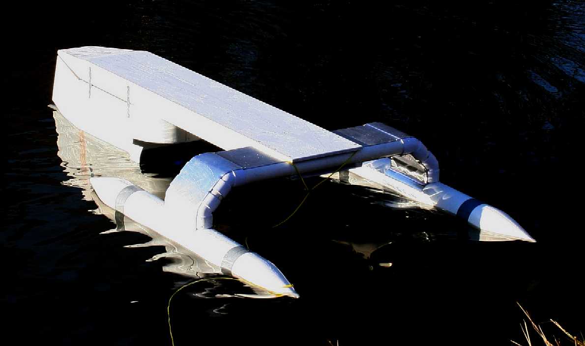
AUTONOMOUS
OCEANOGRAPHIC SURVEY SHIP
The
SolarNavigator is equipped to carry out oceanographic tasks such as surveys, autonomously. The speed of the ship, coupled with its robotic
endurance and payload for onboard equipment, could accelerate surveys of the ocean floor that are long overdue
to maintain and improve the accuracy of admiralty charts.
In
addition, the ship may be operated as a drone and may be crewed
as and when required.
PLATFORM
SUMMARY - SNAV - Long-range, High
Endurance Unmanned Surface Vessel
The SolarNavigator
autonomous ship is long-range, high endurance ship able to perform a variety
of environmental monitoring, data-gathering and surveillance missions for
researchers, the military and offshore oil
& gas engineers at greatly reduced cost compared to traditional surface
ship operations.
SolarNavigator may receive commands and transmit collected data via
satellite for continuous monitoring of programmable mission parameters to
allow for instant analysis of collected data without fear of loss.
The
concept and all of the design IP is now the property of Bluebird
Marine System Ltd (BMS). BMS is developing variations of the theme, to
include ocean scrubbers, to tackle the plastic pollution problem in the 5 main
ocean gyres, where plastic is now a part of the food chain and a serious
health risk to humans.
Applications:
* Physical, Chemical and Biological Oceanography
* Marine Environmental Monitoring and Time Series Data Collection and
Reporting
* Hydrocarbon and Biochemical Detection
* Current Profiling
* Tactical Oceanographic Surveys
* Remote Autonomous Surveying
* Persistent Monitoring
* Persistent Surveillance
Unlike many subsurface vehicles currently in use for surveys Solarnavigator
may carry significantly more equipment and conduct operations faster which
opens the door to future complex multi tasking missions.
SolarNavigator Sensor Integration:
* CTD and dissolved oxygen sensors.
* Biomass sensors to analyze the food chain
*
Echo sounding for ocean bed contouring
*
Temperature monitoring
*
Ocean current trends
*
Wind and wave
data
*
Weather patterns

Manuel Maqueda, the co-founder of the Plastic Pollution Coalition is quoted as saying that we're stuck. We understand plastic pollution issues, but we don't have the solutions. The voice of the Earth is not being heard. He was driven to seek plastic pollution justice after a conversation with oceanographer Captain Charles Moore, who is also the founder of the Algita Marine Research Foundation. Moore shared with him what appeared to be a bag of sand which, Maqueda realized, was a bag of minute pieces of plastic. Moore told Maqueda,
"that's the beaches of the future…. It's the global warming 30 years ago coming to us now.” Maqueda wanted to take action, to solve environmental issues that were being ignored. After research and collaboration with Google Earth, he gathered a group of individuals with a shared interest and passion for plastic pollution justice to meet at the Google Headquarters. Together they addressed
"what this problem is, what the solutions are, and what the solutions are not."
One practical solution is to adapt a fleet of solar powered drones to clean
up the oceans. The NOC were approached in 2013 with such a suggestion and
got no reply. The Technology
Strategy Board rejected an application for funding in May of 2013.
Bluebird Marine Systems has a published patent that covers a system for such
a clean up, but needs financial support for the research needed to make it
happen.
ACIDIFICATION
- ADRIATIC
- ARCTIC
- ATLANTIC
- BALTIC
- BERING
- CARIBBEAN
- CORAL
- EAST
CHINA
ENGLISH
CH - GULF
MEXICO - INDIAN
- MEDITERRANEAN
- NORTH
SEA - PACIFIC
- PERSIAN
GULF - SEA
JAPAN
STH
CHINA - PLASTIC
- PLASTIC
OCEANS - SEA
LEVEL RISE
|
Welcome
- Youtube
|
Oceanography
- Youtube
|
|
Sealife
- Youtube
|
High
Seas
- Youtube
|
|
Sealife
- Youtube
|
High
Seas
- Youtube
|
|
Sealife
- Youtube
|
High
Seas
- Youtube
|
LINKS:
Metropolis
Magazine April 2011 Plastic Pollution
NASA
Jet Propulsion Laboratory - Physical Oceanography Distributed Active
Archive Center (PO.DAAC).
Scripps
Institution of Oceanography
Woods
Hole Oceanographic Institution (WHOI)
British
Oceanographic Data Centre
NOAA
Ocean and Weather Data Navigator
Freeview
Video 'Voyage to the Bottom of the Deep Deep Sea' Oceanography Programme
Glossary
of Physical Oceanography and Related Disciplines
1785:
Benjamin Franklin's 'Sundry Maritime Observations'
History
of the Gulf Stream
Deep-Sea
Prospectors Seek Radium from the Ocean Floor.
NOAA
National Sea Grant Office (NSGO).
Impact
from the Deep
OSC
Limited UK Spott Road Dunbar, East Lothian Scotland, EH42 1RR T: +44 (0)1368 865
722 M:+44 (0)7866 047 390 F: +44 (0)1368 865 729 W:
http://www.metropolismag.com/Point-of-View/April-2011/Plastic-Pollution/
Caring
for the planet...

A
heartwarming tale of triumph over adversity.
Human
whalers v humans
who care about marine life
BLUEFISH
DEVELOPMENT PROJECT INDEX A-Z
|