|
A
puzzling mountain-side object in Turkey is the
target of a hide-and-seek game of biblical
proportions. The
high-flying and super-powerful commercial
QuickBird satellite has begun snapping imagery of
Mount Ararat in eastern Turkey - in a quest to
spot the possible remains of what is believed to
be Noah's Ark.
Aircraft
pictures taken in the late 1940s, as well as more
recent secret spy satellite shots of the area do
show something odd - a bit of strangeness that has
earned the title of the "Ararat
Anomaly". The
search is on to identify that peculiar blemish in
photographs. Perhaps
it's little more than a natural, albeit eye
catching, geological formation. On the other hand,
that anomaly could have a classic tale to tell,
one that reaches back into biblical times.
On
the lookout trail
Most
Biblical scholars and Near Eastern archeologists
and historians regard the Biblical accounting of
Noah's Ark and a world-devastating flood as a
story handed down by oral tradition.
|
|
|

|
|
|
|

|
|
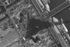
Mt.
Aratat captured by Ikonos
on August 11, 2000.
Click-to-Enlarge.
|
|
|
|
|
|
|
|
|
|
|

|
|
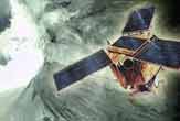
QuickBird
2 satellite will use its
super-powerful camera
system to image Mt. Ararat
in search for remains of
Noah's ark. credit:
EarthWatch Inc.
|
|
|
|
|
|
|
|
|
|
|
|
|
DigitalGlobe's
powerful QuickBird
satellite is cranking out
ultra close-up imagery of
Earth targets. As example,
this picture shows the
Eiffel Tower in Paris,
France -- taken March 27,
2002-- and demonstrates
the quality of pictures
churned out by the
high-flying satellite.
Credit: DigitalGlobe
|
|
|
|
|
|
|
|
|
|
|
|
|
|
|
|
|
|
|
|
|
|
|
|
|
|
|
|
|
|
As
told in the Bible, Noah constructed a large boat
to house his family and sets of animals, saving
them from flood waters due to 40 days and 40
nights of deluge. Once this Great Flood retreated,
as depicted in the Book of Genesis, the ark
settled down on the mountains of Ararat.
On
the lookout trail for the real deal is Porcher
Taylor, a senior associate (nonresident) at the
prominent think tank, the Center for Strategic and
International Studies (CSIS) in Washington, D.C.
He is an expert on satellite intelligence
gathering and diplomacy.
Taylor
has worked for years to compel the U.S. Central
Intelligence Agency (CIA) to declassify satellite
images and other information related to the
unidentified feature perched on Mt. Ararat in
Turkey. Indeed,
the secrecy wraps have come off a partial set 15,500-foot
level on the mountain's Northwestern Plateau.
In
later years, Taylor contends, two high-powered
intelligence-gathering satellites -- the Keyhole-9
in 1973 and the Keyhole-11 in 1976 -- aimed their
cameras at the mountain. What those photo shoots
purportedly show created a stir amongst photo
interpreters.
The
anomaly is more than 600-feet long (183 meters),
Taylor said, at least the section visible in
aerial and satellite imagery. Photo interpretation
specialists, he said, do think they perceive
actual boat structure in the pictures.
Yet
those images remain classified at the moment.
Remaining unclassified, however, is Taylor's
passion. "I
want to solve the enduring mystery of the Ararat
Anomaly, no matter what it may be," he told SPACE.com
Peeking
at the peak
Thanks
to the advent of commercial remote sensing
satellites, taking a peek at the object on Mt.
Ararat for a fee is feasible. In October
1999 into the summer of 2000, images of the
mountain and the object in question were snapped
by the IKONOS spacecraft, owned and operated by
Space Imaging, based in Thornton, Colorado. Those
pictures didn't resolve the issue, one way or the
other, however. Now
the lenses of another commercial satellite,
QuickBird, operated by DigitalGlobe of Longmont,
Colorado is on the prowl. "QuickBird is
capable of shedding more light on what the anomaly
may or may not be," Taylor said.
QuickBird
was lofted in October 2001 and is billed as the
world's highest resolution commercial imaging
satellite. It can see things 2-feet
(61-centimeters) across.
"We
have acquired four images of Mt. Ararat and all
have been cloud covered to date," said Chuck
Herring, Director of Marketing Communications for
DigitalGlobe. "We continue to task this event
and will get Porcher Taylor an image as soon as we
get a good image," he told SPACE.com.
Clear
sailing
Taylor
is anxiously awaiting clear sailing by QuickBird
over Mt. Ararat.
"Because
of constant cloud cover it's tough. Where this
thing is, whatever it is…it's basically
glacier, a permanent ice cap at 15,000 feet up on
the mountain. It is a unique and unexplored site
on Mt. Ararat. You're going to have to have ideal
weather conditions and a lot of luck when you're
flying over to see it," Taylor said
Meanwhile, Taylor anticipates that when QuickBird
does produce the imagery goods, he'll have more
leverage to convince U.S. President Bush and his
administration to declassify those earlier Keyhole
satellite shots.
Taylor
may not have to wait too long. Next month,
the National Imagery and Mapping Agency unveils a
load of vintage Keyhole-7 and Keyhole-9 pictures,
declassifying the images and making them available
for public scrutiny. He hopes Mt. Ararat photos
are among those being released.
Imagery
team
Taylor
has at the ready a "world class" imagery
team, ready to huddle over any new QuickBird
images or older Keyhole photos. A
leader in that team is Farouk El-Baz, research
professor and founding director of Boston
University's Center for Remote Sensing.
El-Baz
first gained world attention for his work on the
Apollo program. He served as secretary of the
lunar landing site selection committee, chairman
of the astronaut training group, and principal
investigator for visual observations and
photography.
A
native of Egypt, El-Baz later served as a science
advisor to Egyptian President Anwar Sadat and to
King Hussein of Jordan.
He
has been a pioneer in developing the field of
remote sensing and is offering his expertise to
what's truly resident on Mt. Ararat.
"There
is absolutely enough hearsay…enough discussion
about the topic to warrant looking into this, to
see whether there is something tangible or
not," El-Baz told SPACE.com.
Unveil
the truth
El-Baz
recounted his conversations with former Apollo 15
moonwalker James Irwin. The astronaut, now
deceased, mounted six expeditions to Mt. Ararat in
a search for the ark. Those treks were done
through his High Flight Foundation, a non-profit
evangelical organization based in Colorado
Springs. "Irwin
told me he saw something. He felt it was an
imprint on the land of the boat that was turned
upside down…perhaps with some soil on top. So
there was something there in his mind," El-Baz
said. El-Baz
himself remains true to his training, waiting for
scientific data to become available and help
unveil the true nature of the Ararat object.
"There
is absolutely nothing in all the pictures that we
have seen up to now that is questionable in my
mind. I can explain each and everything as a
natural snow bank…a shadow. There is
nothing," El-Baz said. But given the interest
and the historical nature of such a find, the
search is worth conducting, he added.
"From all the points of view, there is
definitely enough in this to warrant spending time
to resolve the issue, one way or the other. So I
don't consider it a waste of time," El-Baz
said.
|