|
MAP
OF HERSTMONCEUX SHOWING THE RELATIONSHIP
BETWEEN
HERSTMONCEUX VILLAGE & LIME PARK
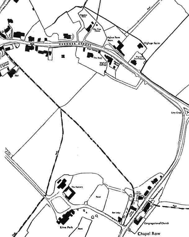
The
map above shows Gardner Street, the A271, which passes
through the village west to east (left to right) to Lime
Cross, a triangle junction seen center right. The
triangle at Lime Cross leads into Church Road (Chappel
Row), seen in the photograph below. Two footpaths
are show in dot-dash form, converging at the top of a
hill leading to the village cricket grounds. Lime
Park is in the lower left quarter. The Old Steam
House is adjacent to The Rectory (a nicely converted
stable block).
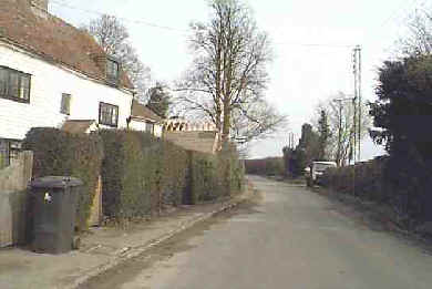
Church
Road proceeding to Lime Cross
Herstmonceux
Electricity Generating Works Circa. 1900 - 1936
Introduction
| Instructions
| ISBN
| Batteries
| Boiler
Room | Floor
Plan | Ron
Saunders
Industrial
Revolution
| Lime
Park | Machinery
| Map
| Power
House | Argus
1999
Public
Supply | Roof
Construction | Rural
Supply | Sussex
Express 1913 |
Conclusion
Archaeology
South East
| East
Sussex CC | English
Heritage | SIAS
| Sx
Exp 1999
Memories
of Herstmonceux by Margaret Pollard
|